Rambles
Discover some of Eden's beautiful countryside, scenic routes and history with some of these rambles.

Acorn Bank to Temple Sowerby walk
The National Trust website has a walk which takes in the industrial heritage of
Acorn Bank, as well as offering panoramic views across the Eden Valley to the Lakeland mountains.
- Acorn Bank to Temple Sowerby - (3.2 miles / 5.12km / 1 hour 30 minutes
Appleby Riverside Walk
Enjoy waterside walking along the River Eden and Hoff Beck on this circular walk around Appleby-in-Westmorland. The route runs for about 7 miles on fairly flat paths, with wonderful views of the Eden Valley and nice woodland trails.
-
Appleby Riverside Walk (around 7 miles)
Armathwaite and Coombs Wood, Armathwaite
This route starts from one of the loveliest of the Eden Valley's villages and then enters pretty woodland beside the river. Having visited the hamlet of Longdales, the route heads along a seemingly forgotten track between hedgerows that are a riot of colour in the early autumn.
This walk has been extracted from the Cicerone guidebook 'Walking in Cumbria's Eden Valley' by Vivienne Crow.
The book is available to buy from Penrith Tourist Information Centre.
- Armathwaite and Coombs Wood, Armathwaite - (3.5 miles / allow 1.5 hours)
The Eamont Way
 Bridge Steamer Pier, offering an ‘Active Travel’ alternative to the car, bus, or taxi.
The route closely follows the course of the river Eamont, crossing it twice. It starts with a series of signed pedestrian crossings from the railway station to the edge of the town, then follows a series of signed footpaths, bridleways and ‘permitted paths’ to exit at ‘The Sun Inn’ in Pooley Bridge. From there it is less than 1/2 mile to the pier for the Ullswater Steamers where onward lake travel to Howtown and Glenridding is on offer and onward from Glenridding to Aira Force.
- For more information visit the Friends of the Ullswater Way website.
Ullswater
Enjoy the beauty of the Lake District National Park with walks around Ullswater.
The National Trust website lists some great walks around Ullswater:
- Aira Force and Gowbarrow trail (4.5 miles / 7km / 1 hour 30 minutes to 3 hours) has some dramatic walking routes, renowned in Victorian times as a beauty spot situated by Lake Ullswater near Watermillock. There is a tearoom and dogs on leads are welcome. There are Information boards situated in the car park which describe the walks or visit the Aira Force website.
- Patterdale and Glenamara Park trail (2 miles / 3.2 km / 1 hour) this walk offers stunning views of mountains and water and is suitable for all - but bring waterproof boots depending on the season as it can get pretty wet underfoot!
- Aira Force Glencoyne Farm trail, 3 miles (4.8km / 2 hours). Glencoyne is one of the largest hill farms in the Lake District. This circular trail will take you through the Grade II listed farm buildings (the earliest part built in 1629) and along to the remains of old charcoal pitsteads. It passes Glencoyne wood, before bringing you back to the car park.
- Hayeswater Gill trail, 2 miles (3.2km / 2 hours). Hayeswater Gill runs down from Hayeswater Reservoir, which once fed into north-west England's water supply. From Hartsop village near Ullswater, follow the beck up to the reservoir on a circular walk surrounded by towering Lake District fells. Discover local mining and milling history as you go.
The Ullswater 'Steamers' website lists some great walks around Ullswater. This includes walks from Howtown to Pooley Bridge, Howtown to Glenridding and a circular walk to Aira Force.

Westmorland Dales Geotrails
Discover three geology walks in the Westmorland Dales produced by the Westmorland Dales Landscape Partnership Scheme with grant funding from the National Lottery Heritage Fund. Written by Elizabeth Pickett and designed by Marcus Byron with contributions from Cumbria Geoconservation.
The three walks include a Smardale Geology Walk, Orton Scar and Knott and Kirkby Stephen and Stenkrith.
- Download the guides on the Friends of the Lake District website.
Walks in Eden's Nature Reserves
Why not explore one of the Nature Reserves in Eden? This gives you the chance to see meadows, ancient woodlands and grasslands as well as flowering plants, butterflies and dragonflies, birds and lots more wildlife.
Cumbria Wildlife Trust and Natural England manage several Nature Reserves in Eden including:
- Thacka Beck, Penrith
- Newton Reigny, Penrith
- Argill Woods, near Brough
- Argill Pasture, near Brough
- Waitby Greenriggs, near Kirkby Stephen
- Smardale Gill, near Kirkby Stephen
- Tarn Sike, near Orton, Penrith
- Cliburn Moss, near Penrith
- Great Asby Scar, Orton
- Tarn Moss, near Penrith
North Pennines National Landscape
There are some spectacular walks to enjoy around the North Pennines where you can explore the spectacular landscapes, geology, flora and fauna of this wonderful area.
Walks include:
- Ashgill Force Waterfall
- Garrigill Round (14km)
- Geology and Landscape around Dufton (6km)
- Knock Geological Trail (10km)
- North Pennines Bird Walk: Garrigill
- North Pennines Bird Walk: Dufton Pike
- Tynehead Geological Trail (4km)
- Whitesyke and Bentyfield Mine (4km)
- Whitely Castle: Alston Through the Ages (12km)
Visit our Walking leaflets and OS Maps webpage for details of corresponding OS maps available and the North Pennines National Landscape website for more information.
Discover Eden Walking Series
This is an excellent series of walks in Eden, originally produced by the East Cumbria Countryside Project and can be downloaded from the Eden Rivers Trust website. Routes include:
Appleby-in-Westmorland, Hoff and Great Ormside walk: (7 miles/11km). A walk with a castle, two churches, two rivers, two water mills and a waterfall

Brougham and Eamont Bridge Trail: (3¾ miles/6 km). A walk with two rivers, a Roman fort, a castle, a fortified manor house, and two ancient henges
Church Brough Walk: (6¼ miles/10km) is a walk through an ancient farmed landscape, with two churches, a Norman castle, a river, a pub and a castellated folly. There are stunning views every step of the way.
Crosby Ravensworth Walk: (3.5 and 6 miles/ 5.5km and 10km). A walk with a church, a ruined 14th century tower house, lost villages, heather moors and woodland, and the source of the River Lyvennet
Kirkby Stephen, Ewbank Scar and the Nine Standards Walk: (4 3/4 miles/7.5kms). A walk with a small cathedral, a Viking god, exotic parrots, wild woods, a towering limestone cliff and nine mysterious cairns
Ravenstonedale and Smardale: (7.5 miles/12km). A walk with two nature reserves, three pubs, an ancient church and priory, a flower rich meadow, a meandering beck, Giants' Graves and a railway viaduct
Shap and Rosgill: (4.5 miles/7.5km). A walk through cattle country with the River Lowther, mysterious earthworks, standing stones and the ruins of an Abbey. There are spectacular views of the Lake District mountains

Lacy's Caves Walk: (4.5 miles/7km). A walk discovering a water mill, the river, a hermit's cave, a lost village, a church and a druids' circle
Please note: The footpath is closed from Little Salkeld to Lacy’s Caves until further notice and is not accessible.
Mallerstang, Wild Boar Fell and Pendragon Castle Walk: (5¾ miles/9kms). A walk along an ancient green highway with mountains, an iconic sculpture, a deep gorge, a waterfall, the Settle-Carlisle railway, and the infant River Eden


Sign up for our e-newsletter

Walkers can collect unique stamps at 29 locatio...
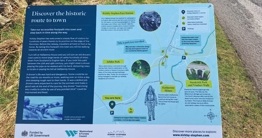
Fantastic new interpretation panels will help v...
In need of a conference venue?