Cycle Routes - Alston and North Pennines
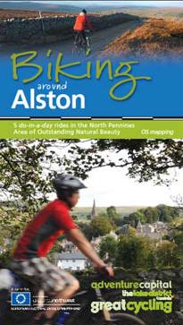
All cycle routes in this section are taken from the 'Biking around Alston' guide (available free from local Tourist Information Centres) and start from or near Alston, one of the highest market towns in England. This former mining town is now popular for the walking and cycling opportunities on Alston Moor, which forms part of the North Pennines National Landscape.
Downloadable Alston and North Pennines Cycle Routes:
- River South Tyne
- Newshield and West Allendale
- Nenthead and Garrigill
- Cross Fell (Mountain bike ride)
- Brampton and Haltwhistle Tour
About the Cycle Routes:
All cycle routes include a variety of on and off road routes. These suggested routes are a brilliant starting point for exploring and discovering this wild and beautiful area on two wheels. It is a good idea to have an OS map to hand.
A bicycle gives you the freedom to explore this scenic area at your own pace, stopping as you choose to appreciate the views and discover the legacy of its rich mining heritage. The C2C (Sea to Sea) Cycle Route, part of the National Cycle Network and the Pennine Cycleway both pass through the Alston area.
The following maps cover the areas featured in these cycle rides:
1:25,000 Outdoor Leisure: OL31 North Pennines (Teasdale and Weardale) / OL43 Hadrians Wall (Haltwhistle and Hexham)
1:50,000 Landranger: 86 Haltwhistle and Brampton (Bewcastle and Alston) / 87 Hexham and Haltwhistle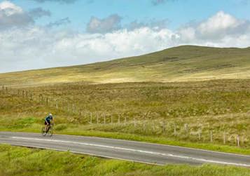
Route Grading
Route grades are expressed by route length, plus degree of difficulty - calculated as average height gain (metres) per kilometre - plus steep gradients.
Distance (miles):
- Short: up to 10 miles
- Medium: 10 - 25 miles
- Long: over 25 miles.
Height Gain (m per km):
- Easy: up to 10m per km
- Moderate: 10 - 15m per km
- Hard: 15 - 20m per km
- Challenge: over 20m per km
If you are looking to hire a bike when you are here, cycle hire is available.

Sign up for our e-newsletter

Celebrating 150 years of the Settle-Carlisle li...

Integrated ticket allowing seamless travel acro...
In need of a conference venue?