River South Tyne
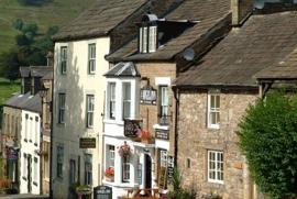
Tracing the course of the River South Tyne downstream from Alston, this route provides an excellent short introductory ride to the area. It first heads out along the fell lanes on the eastern side of the river steadily gaining height to Barhaugh Hall then descending by Blackcleugh Burn to the banks of the South Tyne River. The river bank makes an excellent spot for a rest or a picnic, after which the road bridge just south of Slaggyford allows the other side of the river to be reached.
The return to Alston involves another climb to start with but once height is gained glorious views open up across the fells and down into the valley where you might just spot steam trains on the South Tynedale Railway, England's highest narrow-gauge railway.
CAUTION: this route features a steep descent going into a tight bend, just past Barhaugh Hall going N.
- Start/Finish: Alston, GR NY 718 465
- Distance: 10 miles (16km)
- Grade: Short - challenge
- Refreshments: Cafés: Alston
- Pubs: Alston
Download this Cycle Route and Map:
Further information
Alston Tourist Information Centre (Local Links), Town Hall, Alston
Telephone: 01434 382244
Email: Alston.LocalLinks@westmorlandandfurness.gov.uk
Penrith Tourist Information Centre, Middlegate, Penrith
Telephone: 01768 867466
Email: Pen.TIC@westmorlandandfurness.gov.uk


