Walking leaflets and OS Maps
OS Maps covering Eden
- OL 5 The English Lakes North Eastern Area - OS Explorer (1:25 000 scale)
- OL 19 Howgill Fells and Upper Eden Valley - OS Explorer (1:25 000 scale)
- OL 31 North Pennines - OS Explorer (1:25 000 scale)
- OS 86 Haltwhistle and Brampton Landranger (1:50,000)
- OS 91 Appleby-in-Westmorland Landranger (1:50,000)
- OS 90 Penrith, Keswick and Ambleside area Landranger (1:50,000)
Available from Eden Tourist Information Centres and from Eden's Outdoor Shops. The full range of OS maps is available from Penrith Tourist Information Centre.
Wainwright's Guides
The Wainwright Guides (Pictorial Guides to the Lakeland Fells) describe and illustrate the Wainwright walks.
Eden's part of the Lake District also contains numerous other fell walks that feature in Wainwright's popular pictorial guides for 'The Northern Fells', 'The Eastern Fells' and 'The Far Eastern Fells'.
The Wainwright guides are available to buy from most Eden Tourist Information Centres, and in Eden's Outdoor Shops. Alternatively visit The Wainwright Society website for more information.
This is just a taster of the walking books and maps available for Eden. For the full range, contact one of the Eden Tourist Information Centres.
Walking leaflets for Alston
The following leaflets are available to purchase from Alston and Penrith Tourist Information Centre.
- Alston's Nent Valley - (3 miles/4.8km, 1.5 to 2 hours). Alston Moor offers clear air and magnificent views which contrast
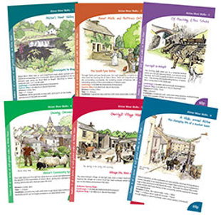 with the industrial archaeology of its mining past. Much of this is evident on the quiet, pleasant walk along the River Nent to Blagill, returning to Alston on a medieval road, now a bridle path
 - Annat Walls and Nattrass Gill - (4 miles/6.5km, 1.5 to 3 hours). Through fields and past farmhouses, this walk gives you a chance to see at close hand the farming life of Alston Moor. There are magnificent views of the surrounding countryside, the tumbling stream of Nattrass Gill, a most interesting variety of flora and evidence of Alston's past
- Of Poaching and Poss-Sticks - (4.5 miles/7.2km, 2 to 4 hours). This exciting walks takes you to a waterfall behind which you can join dancing fairies. It returns along the River Tyne with a wealth of plants and birds to be seen. The mining and smallholding history of Alston Moor comes alive in the landscape
- Gaining Ground - (2 miles/3km, 1 to 2 hours). Your walk takes you through four areas that are owned and administered for the benefit of the population of Alston Moor. This walk gives you a glimpse into the strong community ethic that pervades life here
- A Walk Around Alston - (1 mile/1.5km, 45 minutes to 1 hour). This walk gives you a glimpse of Alston town's fascinating history. There's an option to double the walk length to take in the South Tynedale Railway.
- Garrigill Village Walk - The now-tranquil village of Garrigill was once a major lead-mining centre. Explore the village on a short stroll (on road surfaces) which will introduce you to the history and present life here
- Water Power in Alston - (1.5 miles/2.4km). One small stream was channelled to provide power for many mills. This walk follows the course of the mill race through Alston
- South Tyne Trail - follows the route of the River South Tyne from the source to Haltwhistle. Open to walkers and cyclists it is almost 23 miles (36.5km) long. It is a fantastic way to experience the North Pennines


Sign up for our e-newsletter

Celebrating 150 years of the Settle-Carlisle li...

Integrated ticket allowing seamless travel acro...
In need of a conference venue?